Urban Drone Autonomy Relies on Layered Sensor Fusion and Adaptive Algorithms
Written by Quinn Lange · Aug 22, 2026
Urban Drone Autonomy Relies on Layered Sensor Fusion and Adaptive Algorithms
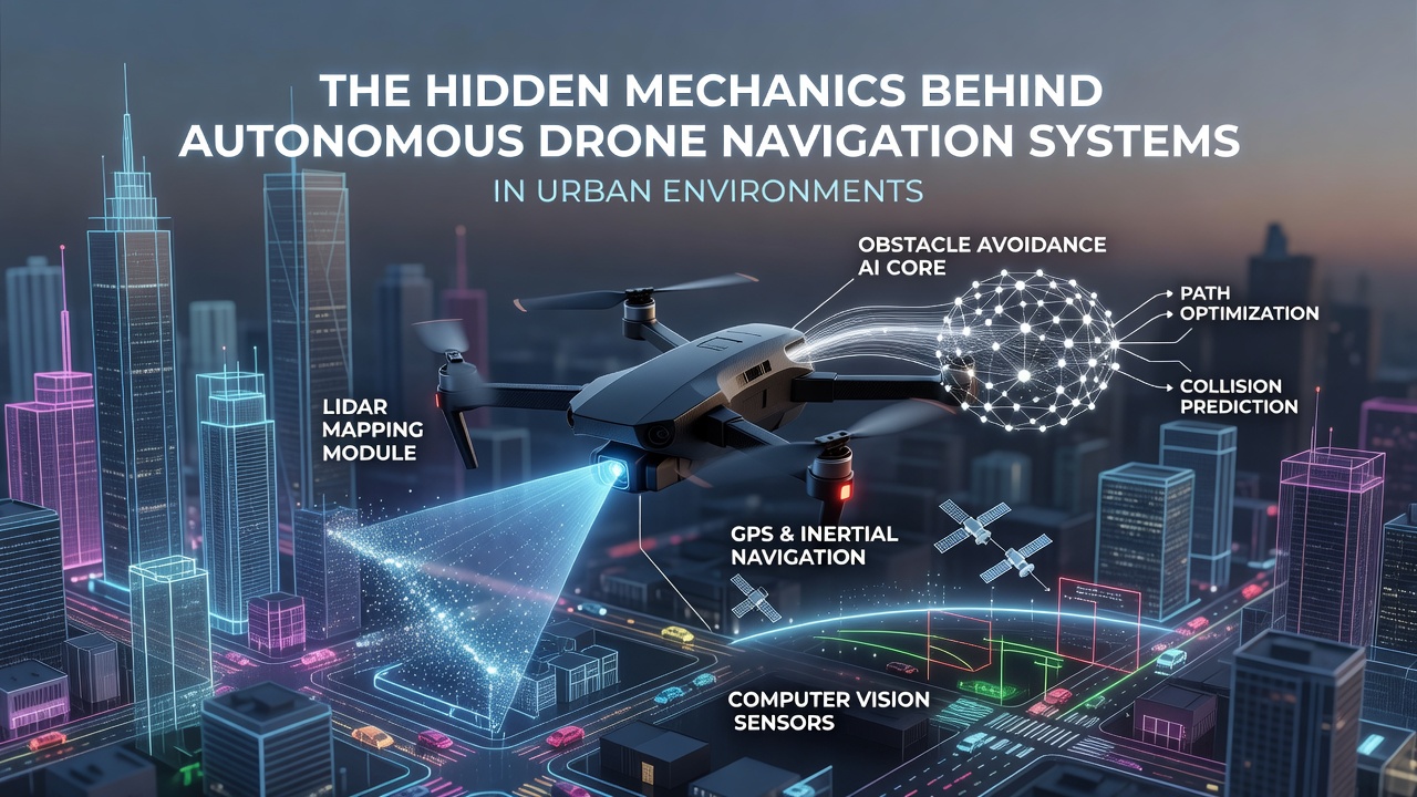
Autonomous drones operating in city environments combine multiple navigation layers that process real-time inputs from cameras, LiDAR units, radar modules, and inertial measurement systems, and these components exchange data through onboard computers that apply sensor fusion techniques to maintain positional accuracy when satellite signals weaken among tall structures. Research from institutions tracking urban aviation shows that signal multipath effects and building occlusion create frequent GPS degradation, which forces systems to switch to visual odometry and simultaneous localization and mapping routines that rebuild environmental models on the fly.
Engineers design flight controllers to prioritize obstacle detection at distances under 50 meters using stereo vision pairs and time-of-flight sensors, and the resulting point clouds feed into path-planning modules that recalculate trajectories several times per second to avoid dynamic elements such as vehicles, pedestrians, and construction cranes. Studies conducted by European aerospace laboratories indicate that urban wind patterns generated by building corridors can reach speeds exceeding 15 meters per second, prompting flight software to incorporate aerodynamic compensation routines that adjust rotor thrust vectors continuously.
Core Hardware Components and Their Integration
Modern platforms mount arrays of solid-state LiDAR units that emit thousands of laser pulses per second, and these measurements combine with RGB and infrared camera feeds inside neural network pipelines trained on millions of annotated urban scenes. Data indicates that thermal cameras help distinguish heat signatures from vehicles and machinery during low-light conditions, while ultrasonic rangefinders provide backup proximity readings at ranges below two meters where optical systems may lose resolution. Observers note that redundant power distribution and shielded cabling protect these subsystems from electromagnetic interference generated by nearby cellular towers and broadcast antennas.
Processors on current models run specialized chips optimized for edge inference, allowing object classification and trajectory prediction to occur locally without constant uplink requirements, and this architecture reduces latency to under 50 milliseconds for critical avoidance maneuvers. Figures from industry reports reveal that battery management systems integrate with navigation software to reserve energy margins based on predicted wind loads and route complexity, extending operational safety margins in variable city conditions.
Algorithmic Approaches to Dynamic Urban Mapping
Navigation stacks employ particle filters and Kalman variants that fuse position estimates from multiple sources, and these filters continuously update covariance matrices to reflect changing uncertainty levels caused by moving obstacles or temporary signal loss. Machine learning models segment semantic classes such as roads, rooftops, and vegetation in real time, supplying contextual information that refines landing zone selection and emergency rerouting decisions. Researchers have documented cases where drones successfully maintained stable flight through simulated GPS-denied zones by relying on visual-inertial odometry loops that match current imagery against preloaded 3D city models updated monthly.
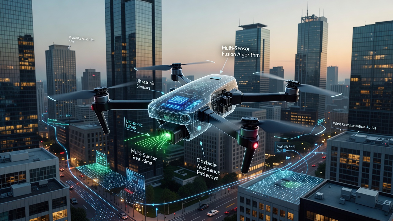
Path optimization routines apply graph-based search methods that treat building facades and power lines as cost-weighted obstacles, and these graphs update dynamically when new sensor data arrives from cooperative drones operating in the same airspace. Evidence from field trials shows that swarm coordination protocols allow multiple units to share local maps, reducing individual computational loads while improving collective awareness of transient hazards such as delivery trucks or window-cleaning platforms.
Regulatory and Operational Frameworks as of August 2026
Agencies including the Federal Aviation Administration and the European Union Aviation Safety Agency have established geofencing databases that embed no-fly zones around airports, stadiums, and sensitive infrastructure, and these databases push updates wirelessly to registered aircraft every 24 hours. Operators must demonstrate compliance with detect-and-avoid performance standards during certification testing, which now incorporates scenario-based evaluations in dense metropolitan test ranges. Data collected through August 2026 indicates that remote identification requirements have expanded to include encrypted broadcast of flight intent, enabling ground control stations to monitor compliance across shared urban corridors.
Training programs for remote supervisors emphasize interpretation of system health telemetry that flags sensor drift or map inconsistencies before they affect flight stability, and simulation environments replicate common urban interference patterns to prepare crews for real-world edge cases. International coordination efforts continue to align frequency allocations for command links and collision avoidance beacons, reducing cross-border interference risks for operators managing fleets that span multiple jurisdictions.
Conclusion
The interplay between hardware redundancy, real-time mapping algorithms, and evolving regulatory databases creates the operational foundation that allows autonomous drones to function reliably within complex cityscapes, and ongoing refinements in sensor miniaturization along with edge computing capacity continue to expand the range of feasible missions without compromising safety margins. Continued data collection from deployed fleets supplies the empirical basis for iterative improvements in both software robustness and airspace management protocols.